Wednesday, February 6, 2013

2013 Spring Piers Information

2013 Slip Renewals and Slip Availability

Spring is just around the corner and its time for slip renewals to start for Oyster Harbor slip holders.


Contracts go out via email about March 1st.  If you plan to renew please send an email or mail in (via USPS) the completed slip lease & check for 2013 as soon as possible.  This way we can know what is available for those desiring slips.

FYI: Although we email contracts, OHCA requires checks and signed leases to be returned by mail.

Based on previous years, we expect to have 3 or 4 boat slips, and 7 or 8 floating dock spaces to come available for new leases as of May 1.


If you are looking for a slip, we should have a good idea by April 1st who is not renewing and what slips are available.

Slip leases run from May 1st to April 30th each year.  Slips are on a first come, first serve basis in the following order:


  1. Currently leasing a slip, fully paid and in no violation of Rules
  2. Slip holder who must be moved due to construction or changes in designated slip use
  3. Slip holders who are over- or under-slipped, i.e., the slip size is too large or is inadequate for the boat
  4. Slip holders desiring relocation
  5. Waiting list - in order received from completed slip request forms 
  6. Those with a slip that has not been fully paid 
  7. Those who have yet to fill out a slip request form
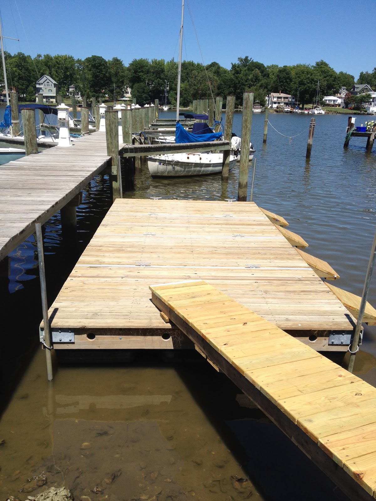
Oyster Harbor currently has the following total slip/storage capacity:

Fishing Creek Pier
  16 Boat slips
    4 Floating dock spaces
  27 Dinghy rack spaces

Booker Pier
  14 Boat Slips
    7 Floating dock spaces
    9 Dinghy rack spaces

Washington Ave Pier
    3 Boat slips
    1 Boat launch ramp

For measurements on all slips, please click here.

If you don't already have a slip and desire one, be sure to fill our a slip request form.  If you are not planning on renewing for 2013, please let us know as soon as possible.

2013 Piers Projects

The following projects are planned for the spring to make the piers more useful to residents and slip holders.
  • New security gate on Fishing Creek (by professional contractor)
  • Rock and stump clean-up on Fishing Creek
  • Water edge clean-up on Washington
  • New (non-squeaky) dink launch ramp on Booker
  • Crab pot and empty oyster cage clean up on all piers
If anyone wishes to volunteer for any of these projects, please let me know.  We will also publish the date of these, once known, on the OCHA Facebook page.

We wish everyone a safe and happy boating season.

Eric
Piers and Harbors Chair


Friday, January 11, 2013

2012 State of the Climate

NOAA Published its 2012 Significant Weather and Climate Event data map which shows some significant climate change records.


For more information, go to http://www.ncdc.noaa.gov/sotc/national/.  It was an interesting year in weather.


Friday, January 4, 2013

Freezing temperatures and boats

As you probably noticed, its a bit chilly outside.


Now that the temperatures will be below freezing each night, and during many days, its important to check the bilge, covers, and low spots in your boats for ice.  After the extensive rains we have had, its possible water got into places you did not expect it to.

Ice can expand and do lots of damage

You can add non-toxic anti-freeze, or salt or drain areas with ice or water.

RV/Marine Antifreeze

Also, with winter will come extremely low tides.  So if you boat is in the water, you may need to check its lines.

Fishing Creek Pier February 2012
Hope everyone has a warm, safe and happy 2013.


Tuesday, December 18, 2012

Marylanders asked to share high tide photos

(The King tides are still present in Oyster Harbor due to local weather conditions, as of Dec 18th)


Reprint from Chesapeake Bay Magazine, Dec/Jan 2012 Issue with inserted local photos from Oyster Harbor.

Maryland is set experience some of the season's highest tides December 12 through 15 and theCoastSmart Communities program is asking for citizens' help in documenting the tides by taking pictures of high water and flooding around their neighborhoods and submitting them here

King Tides as they are often called, give researchers a potential look at what future sea level rise may look like. (http://en.wikipedia.org/wiki/King_tide)
Step onto Fishing Creek Pier during December's King Tide

These photographs will be used in educational and outreach materials to build awareness on how coastal flooding affects Maryland's shoreline. Building a photo library will help researchers understand how floods are impacting area schools, homes, harbors, beaches, public access points and other public infrastructure. CoastSmart will then use this information to create a plan for communities that may experience coastal hazards and increased flooding in the future.

Fishing Creek Pier during December's King Tide

King Tides are not sea level rise and are not related to climate change. If the State and its citizens do not take action however, these tides show what communities could experience as a result of future sea level rise. As sea levels continue to rise, these areas will become more at-risk to the impacts of storm surge, flooding and other coastal hazards, such as Hurricane Sandy. An Environmental Protection Agency fact sheet on King Tides is available here.

For more information on the Maryland King Tides Initiative, including a chart showing when and where tides will be highest and instructions on how to submit a photo, participants should visit dnr.state.md.us/coastsmart/king_tide.asp.  To check out the photo submissions, visitwww.flickr.com/groups/MarylandKingTides.

Those with questions or comments may contact Maryland Department of Natural Resources' CoastSmart Communities Planner, Kate Skaggs, at 410-260-8743 or kskaggs@dnr.state.md.us.

Additional Fishing Creek Pier Photo

Tuesday, November 6, 2012

A Nor'easter's a commin'

We did really well making it through Hurricane Sandy at least from a Piers and Harbors point of view. We had some damage on the Fishing Creek pier which Cory Gassman offered to fix.  We also lost the flag halyard on the Booker pier as the block at the top of the pole rusted through.

Now we have to prepare for a Nor'easter.  This time with the possibility of snow and freezing temperatures with it.

Areas of wind warnings


Currently Annapolis is expecting rain and wind, with the possibility of snow from midday Wednesday until late Thursday.  Although there will be gusts to near 40 kts, the most threatening aspect of the storm is the duration of nearly 48 hours of winds.

As with Hurricane Sandy, please check your boats and boats in racks, to ensure they are tied well and have chaff protection.

As with Sandy, we will try to get updates onto the Facebook community page.

Hope everyone stays warm and dry.

Friday, October 26, 2012

Hurricane Sandy Preparation


OHCA is asking all slipholders to make plans to safe-

guard their vessels from Hurricane Sandy.

Forecasted Path of Hurricane Sandy
We are keeping a close eye on Hurricane Sandy. Some part of the storm is expected to have an effect in our area. Some models suggest the storm will be coming near, but not into the bay.

This means that some amount of wind, rain and storm surge will have an affect on OHCA piers.  The magnitude of the effect can vary greatly.

Storm Surge Effects

While most OHCA piers are shielded from high winds, the rising water from the wind and low pressure can cause a Storm Surge that can not be blocked. Storm surges can raise boats in slips beyond the limit of their lines and the height of the pilings which can pull the boat under water or cause severe damage. 

Here is a quick guide to storm surge effects in Oyster Harbor:
  • Less than 2 feet - normal tide range
  • 3-4 feet - Fishing creek pier may be covered with water and the boat ramp parking lot may be flooded.
  • 4-6 feet - Booker pier may be under water, and Booker parking lot may be flooded. Fishing Creek pier will be well under water with only pilings showing.  Many boats at all piers will have significant strain on their lines and risk being pulled under water.  A risk of electrical shock from pier and other power services will exist.
  • 6-8 feet - All OHCA piers and parking lots will be under water.  Access to boat slips will be by row boat. Washington Ave and Shore Ave will be flooded.  Boats on the dinghy racks will be at risk. Many boat's dock lines will be at their limit.  Fishing Creek boats may bang the top of the pilings and be damaged.
  • 8+ feet - Most streets heading to the water will be flooded.  The emergency fire pumping stations will  be under water. Most boat dock lines will be beyond their maximum stretch and will either part or pull the boats under water.

Below is a link to the tidal surge for our area:


The best way to prepare for Hurricane Irene is to pull your boat out of the water with a trailer or at a local marina.  

If you plan on leaving your boat in the water, below is some advice for hurricane preparedness.
What you will need:
  • extra lines for dock lines and securing canvas and sails
  • chafe protectors
  • fenders
  • duct tape
  • flash light with spare batteries
What you should plan on doing:
  • securing or removing biminis, dodgers, life rings, etc
  • double line your dock lines
  • add additional chafe protection
  • use extra fenders
  • verify batteries are fully charged
  • leave automatic bilge pump on
  • disconnect shore power
  • close fuel valves
  • close all through-hull fittings
  • verify cockpit drains are clear
  • duct tape any non-watertight hatches
  • remove boat papers
  • lock boat
  • secure your dinghy on the dinghy rack
  • assist your neighbors if necessary
  • ensure the piers and harbors committee has your most current contact information - including cell phone
  • do not park cars in any of the parking lots near the piers during the storm
  • check with your insurance company to see if they will pay for haulout and storage fees during a named storm
  • verify your insurance information.  All boats in OCHA rented slips are required to carry liability insurance.
  • Electric power will probably be turned off to all docks during the storm.
  • Don't put yourself at risk during the storm.  
If you have a boat in a dinghy rack, make sure its secured with line.  Don't assume because it higher up that it is safe from wind or water.

Here are some links from BoatUS:
Hurricane Prep Guide
Hurricane Prep Guide 2
(Thanks to Michael Paroby for sending these)


If you have questions, please feel free to contact me, Eric Epstein at 410-575-4001 (eric @ epstein.bz).


Aftermath of Category 3 Hurricane
Other sites to watch for status:  

Prepare early and be safe.  

Lets hope Sandy moves to the east and misses the Chesapeake Bay.

Monday, August 20, 2012

What a great summer it has been!

The Chesapeake Bay has benefited greatly from the lower amounts of rainfall and subsequent reduced runoff of water that come with it.  The Bay's dead zones that exist without oxygen have been smaller, the fish have ventured farther north, and the spawning female crabs swimming south have happened in some of the largest numbers seen in recent years. The reduced algae blooms have left the middle Bay a bit clearer and promoted the growth of sea grasses that are crucial for the Bay ecosystems.  Fishing Creek has seen some of the first Terrapins (Native Bay turtles) live and lay eggs in the creek in many years.

Terrapin caught in crab pot


Of course lower rainfall also brought record Sea Nettle (Jelly fish) counts to the middle Bay, and more barnacles for boat bottoms.

Hurricane season has also been a bit different this summer, with storms staying well south or east of the US East Coast.

NWS logo - Click to go to the NWS homepage
Track Hurricanes at http://www.nhc.noaa.gov/

For this Autumn, there are many predictions as to what we will expect.  For us in Oyster Harbor we can probably expect at least one Tropical Storm to past by and leave some rain and wind before November.  We can also expect the consistent mix of mild and hot days, with the occasional summer thunderstorms.  Rumor has it that the fishing this fall will be better than normal.

As for new things affecting the Piers and Harbors, we have a big list of accomplishments this summer.

  • The Fishing Pier is complete (along with the dredging of the channel and new bulkheads)
  • We have added floating docks to Fishing Creek and Booker Ave piers for dinghy and kayak launching and for  leased space available to store small boats on those floating docks.
  • We have added the ability to pump out port-a-potties (portable types) at the Pump out on Booker Pier
  • We have fixed and expanded signs at beaches and piers to more clearly define rules and usage.
  • We have also gotten stricter about enforcing boats, trailers, and cars that are left in places that block the open use of the piers or parking areas by others.
  • We added an online Slip Request form on the Piers and Harbors Blog to apply for a slip or dinghy dock

New dinghy floating dock details


We have one new dock as Fishing Creek.  It can hold four dinks, kayaks, lasers, sunfish, or other similar sized boat.  Each space is 3.5' x 10' and has tie downs to secure your boat.  Half of the original white dock at Fishing Creek is reserved for boat launching, crabbing, and short term tie ups.

On Booker/Washington Pier we added two floating docks, with a total of seven spaces available.  Four spaces are 3.5' x 10 feet, three are 2.5' x 10' for kayak width boats only (kayaks by be up to 14'), and one is 2.5 feet by 10' where the kayak must be 10' or less. All spaces have tie downs.  Both floating docks have the right side reserved for boat launching.  The one near shore has a ramp to make launching easier.

Leased Spaces are available on a first come, first serve basis, with preference given to those who are less able to carry boats from the racks to the water. 

If you'd like to lease floating dock space or a slip, click on the slip request button above.


We'd also like to thank all the residents who went out of their way to report boats that were taking on water, help find lost boats, and in one case go out of their way to bail out a boat at 2am in high winds.  I believe that because of this care for others in the community, we did not have a single boat sunk, and found the one lost boat that blew away.  Thank you!

Don't think this winter will be as mild as last year. Plan ahead!

On a final weather note, last winter was remembered as the "Winter that wasn't", and many boaters will have that fresh in their minds when planning winterizing and storage for their boats for this winter.  We remind you that the last time this area had such a mild winter was in 1955.  And, only a couple years ago we had the "Snowmageddon".   Winters can vary greatly from year to year in our area, so please plan for a much harsher winter this year than last.

As always, if you have suggestions, ideas, find a lost boat, see one near sinking (even at 2am), or want to rent a boat slip, please let us know.

Fair winds and happy boating,

Eric Epstein
Piers and Harbors Chair
~~~~~(\~~~~~